AKs: 30
Georgia's Geography
Where in the World are we???
http://contentviewer.adobe.com/s/GPB/d095b43f82f94c229327b7debcdc8af4/VFT_Regions_Web/000_GeorgiaMap.html
http://contentviewer.adobe.com/s/GPB/d095b43f82f94c229327b7debcdc8af4/VFT_Physical_Features_Web/000_GeorgiaMap.html
http://www.georgia.org/competitive-advantages/lifestyle/georgia-climate/
| state_outline_map.pdf |
| regions_outline_map.pdf |
AKS 30a
Locate Georgia in relation to region, nation, continent, and hemisphere.
Locate Georgia in relation to region, nation, continent, and hemisphere.
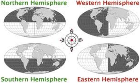
Hemispheres:
Georgia is in the Northern and Western Hemispheres.
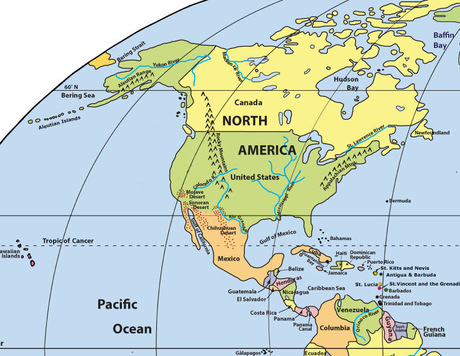
Continent:
Georgia is on the North American continent.
Nation:
Georgia is a part of the United States of America.
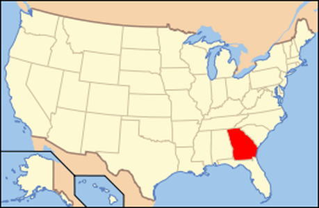
Region:
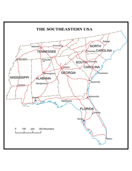
Georgia is a part of the Southeastern Region of the United States.
AKS 30b
Describe the 5 Geographic regions of Georgia.
Describe the 5 Geographic regions of Georgia.
| aks_30_regions_graphic_organizer.doc |
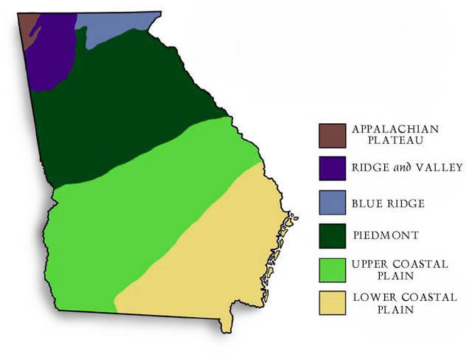
Appalachian Plateau: Located in the Northwestern corner of Georgia and consists of limestone caves, deep canyons, and interesting rock formations. The soil in this region is made of limestone, shale, and sandstone. The area consists of hardwood, pines, forests, and pastures, and is the only known location of coal in the state. TAG
Ridge and Valley: Located in Northwest Georgia between the Appalachian Plateau and the Piedmont regions. It consists of low open valleys and narrow ridges, fertile farmland, pastures, apple orchards, and soybean fields. The soil in this region is made of shale, sandstone, limestone, and clay. This is traditionally a mining region, but there are also textile and carpet industries in the region. It was a major battle ground in the civil war, and is a major transportation route between GA and TN.
Blue Ridge: Located in the Northeastern corner of Georgia and consists mountains, hardwoods, and pines. The soil is made of sandy loam and clay. The land is used for forestry, vegetable farming, and apple orchards. Tourism is an important industry to the area. The highest point in GA, Brasstown Bald, is located in this region and it is also the southernmost point of the Appalachian Trail. This region receives 80 inches of rain a year on average, and provides the majority of the water used throughout the rest of the state.
Piedmont Plateau: Located in the upper-middle section of Georgia and consists of sloping hills and valleys in the north and flatlands in the south. The soil is made of sandy loam and clay. The area has large deposits of granite and produces wheat soybeans, corn, poultry, and cattle.
Coastal Plain: Fall Line-southern 3/5 of Georgia. The soil ranges from limestone to clay. There are two regions of the Coastal Plain: Inner Coastal area consists of mild climate and good water supplies, which makes it an agricultural area. The Outer Coastal area has poorly drained soil, marshes, swamps, deep harbors, and barrier islands. This area is known for its naval stores and the Okefenokee Swamp.
AKS 30c
Locate and evaluate the importance of key physical features on the development of Georgia.
Locate and evaluate the importance of key physical features on the development of Georgia.
| aks_30c_georgia_waterways_notes_chapter_2_2-column.doc |
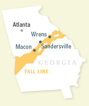
The Georgia Fall Line is the dividing line between the Piedmont Plateau and Coastal Plains regions. The area contains many waterfalls, which were utilized by Indians and settlers as a power source. Differences in soil types between the Piedmont and Coastal regions caused the waterfalls to develop.
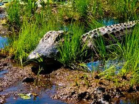
The Okefenokee Swamp is a primitive wetland located in southeast Georgia. It is home to hundreds of species of plants and animals, some of which are endangered.
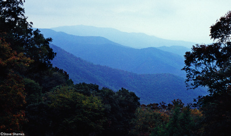
The Appalachian Mountains are located in northeastern Georgia. Brasstown Bald is the tallest point in Georgia and is located in the Appalachian Mountains. The majority of Georgia's precipitation occurs here and provides water for the rest of the state as it runs to the Atlantic and the Gulf of Mexico. The southern entrance to the Appalachian Trail is located in Georgia.
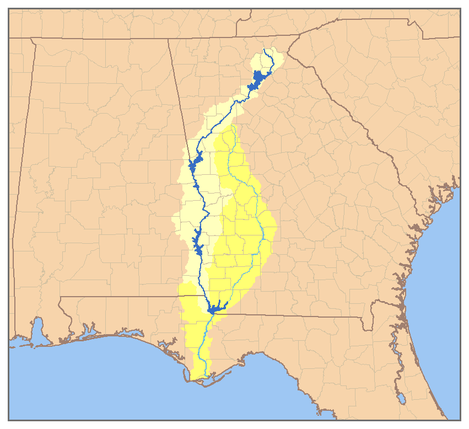
The Chattahoochee River originates in the Blue Ridge region of Georgia. It is 436 miles long and empties into the Gulf of Mexico. It supplies water to many major cities and forms part of the western boundary of Georgia.
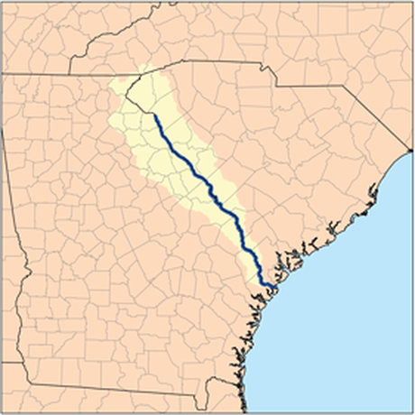
The Savannah River is the only river in Georgia that does not originate within the state. It creates some of the boundary between GA and SC. It is a major transportation route and an eastern boundary of the GA Barrier Islands.
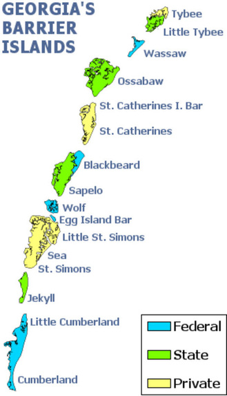
The Barrier Islands protect the mainland from ocean storms and erosion. For those of you who went on the Jekyll Island trip last year, you should know all about this already!
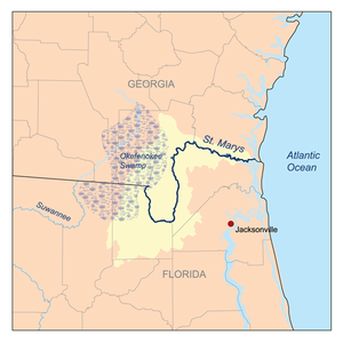
The St. Mary's River forms the southern border between GA and FL.
|
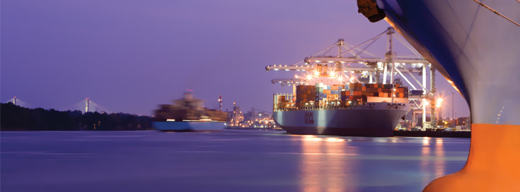
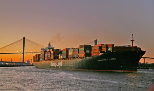
The ports of Savannah and Brunswick are Georgia's two major deep sea ports. The ports generate many jobs, and much trade for the state of Georgia.
|
AKS 30d
Evaluate the impact of climate on Georgia's development
Evaluate the impact of climate on Georgia's development
Georgia has a humid sub-tropical climate. Georgia experiences tornadoes, tropical storms, hurricanes, nor'easters, and extreme thunderstorms. The climate attracts industries to Georgia because there are fewer lost work days due to inclement weather. Georgia receives sufficient precipitation (occasionally punctuated by drought), which is the reason for Georgia's agricultural based economy. After the Civil War, GA remained predominately an agricultural state until the 20th Century and is the 9th most populous state in the nation.
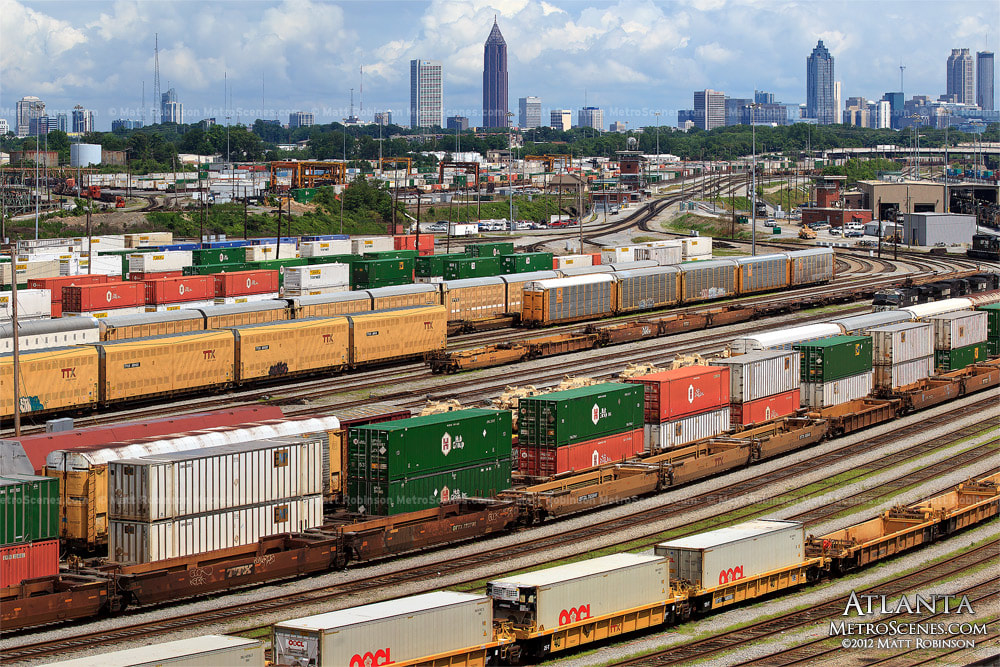
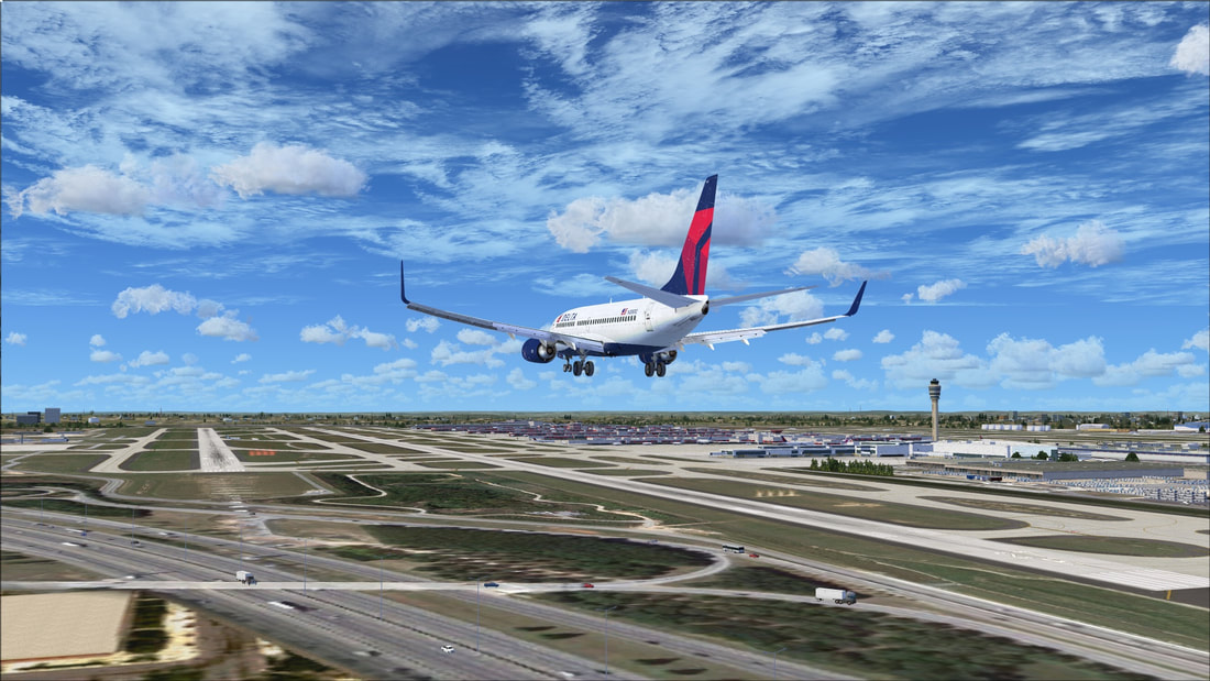
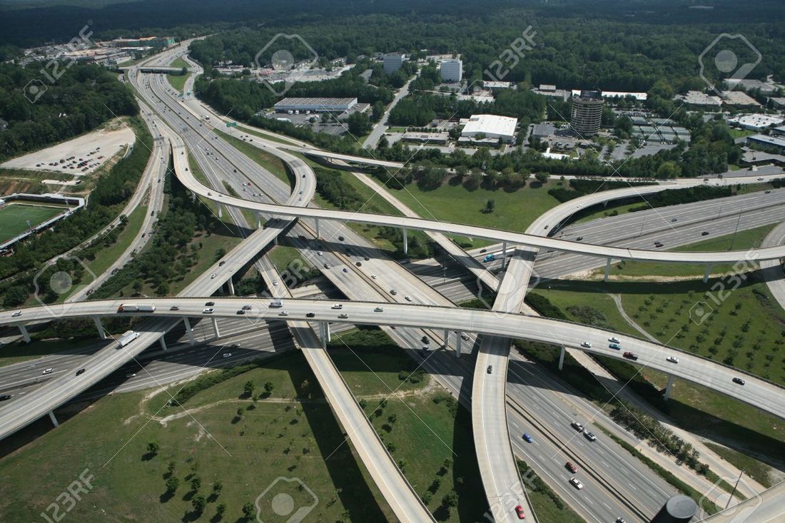
Transportation in Georgia
Georgia has four major transportation systems: Railroads, Deepwater Ports, Interstates, and Hartsfield-Jackson International Airport. These transportation systems are used to distribute goods both domestically and internationally. Items such as cars are shipped into Georgia deepwater ports in Savannah and Brunswick, where they are loaded onto Semitrucks that distribute the automobiles throughout the United states via the interstate system. Planes fly many products into and out of Atlanta as well, where items are loaded onto trucks and shipped to their destinations. These transportation systems provide many jobs in Georgia as well. Not only do we need captains, pilots, truck drivers, and train engineers, but think of all the restaurants, hotels, truck stops, gas stations, dock workers, airport workers, mechanics etc... that are needed to keep these systems running.
|
|
|